This Writing and Interactive Map are both in Progress as of October 19, 2018
Baby Arieanna's father Andrew Christopher Terry has just been released on bond for charges of disposing of a body. Perhaps our Interactive Map constructed on Baby Arieanna's behalf will help target potent areas to plan search efforts. Our maps are not magic, they need to be intelligently considered alongside sound investigative procedure and knowledge of the area and all persons of interest involved so that attention can focus on those areas where vectored planetary patterns are offering potent directions for recovery.
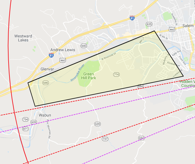
Below is an screen shot image taken from our interactive map showing the southwest direction from point of disappearance with areas hot spotted that are near to water and the rail tracks as reflected by the Sun Neptune Opposition at the time of her disappearance. There are other planetary patterns that need to be considered. This image is just one of them that appeared to be potent based on the fact that rail tracks are running along the river in this direction. If I was there in Roanoke I would check these areas first as highlighted in these two maps below. Our interactive map to explore these areas in a closer look is below. 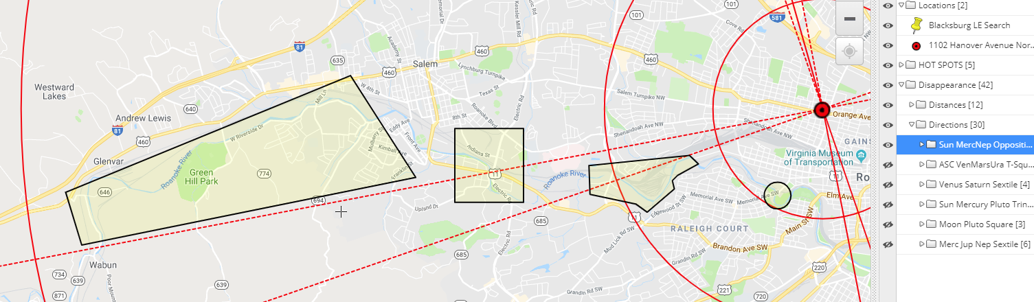
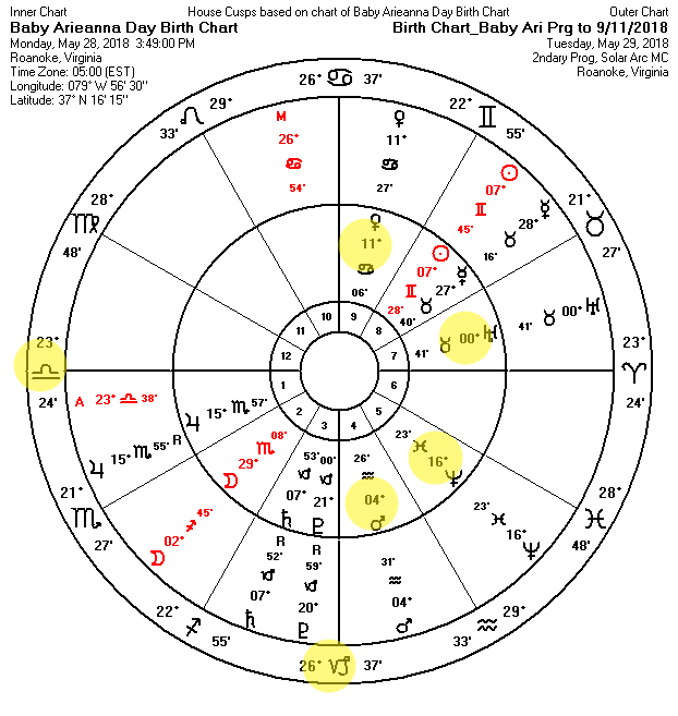
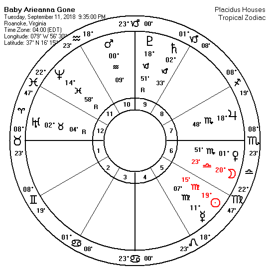
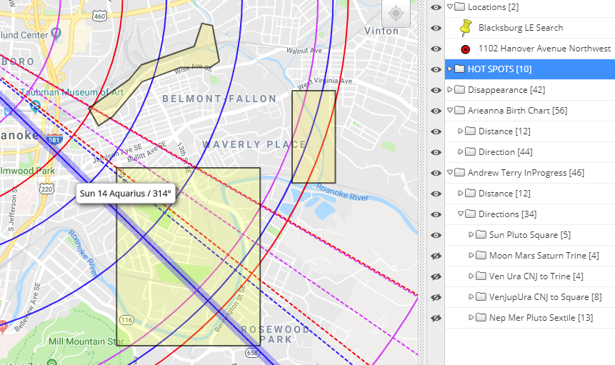
The map below reflects Terry's own Sun vectored (blue line) into the South East area of town near 9th Street SE. The red and pink vectored ley lines are those belonging to Baby Arieanna at birth, and at the disappearance that reflect a triggered a T-Square involving Mars at birth at her disappearance.
Searching for clues in his name ANDREW CHRISTOPHER TERRY I found the troublin' anagram THREW HER CORPSE DRY TRAIN. So this might be telling us that she is not submerged in the water but near rail tracks. Here is another anagram that suggests the area is dry and not wet, HE THREW ARIE DRY RR SPOT with the letter C and N left over, could they mean C (see) N (north or near).
I also found TYRANT HIDE HER CORPSE RR with a W left over that could suggest a direction that is West. WE HIDE HER, C RR TRANSPORT with a Y left over is another disturbing find. Is there road access to areas near the railroad tracks that also have surrounding wooded areas for a disposal? The area could certainly be industrial in nature during the day. YES!, WE HIDE TOT RR CAR ... is just one more way of saying the same thing still using all the letters of his name, ANDREW CHRISTOPHER TERRY. Might be a good idea to learn where this guy worked in the past to see if those places of interest are in directions that also point into areas that are near to or have to do with the railroad. The words, HER ROAD INTERSECT PH RR with the letters W and Y left over could suggest that we need to look at water that is being crossed by the rail tracks. PH is something that we test in water, while the W could stand for West, but unsure about what the Y. Most disturbing find is, THREW ARIE CORPSE NTH RR YD with no letters left over. Everything about this man's connection with a missing baby is telling us we need to set our sites near areas that have to do with the Rail Road. It's important that it is understood these words from his name can be consider against all distances from point of disappearance against roadways that pass over or nearby the railway and the places that have something to do with the Rail Road. So consider our map with what you know of the area, and the possible roads he might of traveled to get from Roanoke to Blacksburg. Is there a known open time window from the time he took Baby Arieanna to his arrival in Blacksburg? Does the time line add up, or is there a time span when he could of rested somewhere secluded with Baby Arieanna in the Roanoke area? or along the way to the Blacksburg area?
However, Baby Arieanna lived on the corner of Hanover Avenue, NW and 11th Street. So I'm wondering if Terry used this road to exit the area? The fact the south end of 11th Street ends at the Rail yard on Shenandoah Avenue is troubling to me? Any place off this road where he could of pulled into and remain unnoticed? How familiar is Terry to this area, where did he live? where did he work? What roads would be a familiar ride to this creep? Look to see if any of the vectors in our planetary patterns in our Interactive align to areas of interest connected to Terry.
Baby Arieanna could very well be some 27 miles from her residence which would be in accordance to her own Mercury at 27 Leo which would put her in the area where police are now searching. I have highlighted these two words TRANSPORT and RESEARCH in the previous paragraph because they both can be born of his name---ANDREW CHRISTOPHER TERRY. So, if LE has good in-tel that they should be looking into this area, than perhaps his name is narrowing down the area to this specific road where there are rail tracks are moving over it. You can click on the above map to enlarge it, or you can use the interactive map below.
Syntax of words in the name ARIEANNA RENEE DAY (still in progress as of 10/19/18)
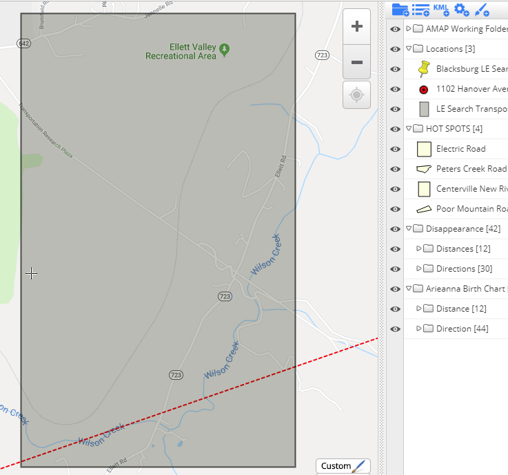
Interactive Map for Whereabouts
Help Us Help Others find Their Missing
Works Cited
0 Comments
Leave a Reply. |

AMAP FOUNDERS
April Gonzalez / Renee Francis If you are here because you are seeking help with a missing person case please use the chat window to reach out to us when we are online.
AMAP funds and supports all Interactive Maps for all missing child cases, as well as the cost for keeping this site available to educate the public on the findings from our study. AMAP
|